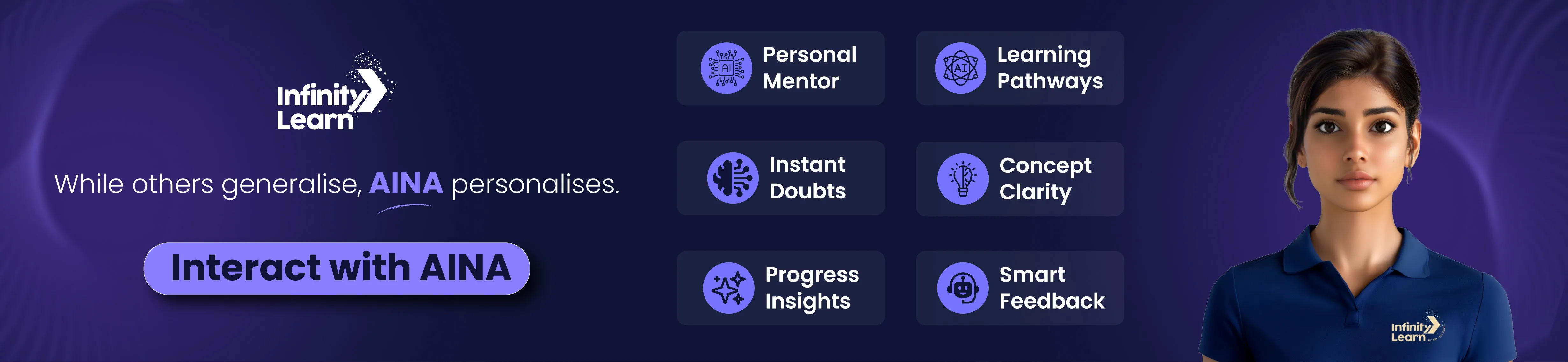
Banner 0
Banner 1
Banner 2
Banner 3
Banner 4
Banner 5
Banner 6

Q.

Read the source given below and answer the question that follows.


The Ganga Plain extends between Ghaggar and Teesta rivers. It is spread over the states of North India, Haryana, Delhi, U.P., Bihar, partly Jharkhand and West Bengal to its East, particularly in Assam lies the Brahmaputra plain. The northern plains are generally described as flat land with no variations in its relief. It is not true. These vast plains also have diverse relief features. According to the variations in relief features, the Northern plains can be divided into four regions. The rivers, after descending from the mountains, deposit pebbles in a narrow belt of about 8 to 16 km in width lying parallel to the slopes of the Shivalik. It is known as bhabar. All the streams disappear in this bhabar belt. South of this belt, the streams and rivers re-emerge and create a wet, swampy and marshy region known as terai. This was a thickly forested region full of wildlife. The forests have been cleared to create agricultural land and to settle migrants from Pakistan after partition. Dudhwa National Park is in this region.


The Ganga Plain extends between which two rivers?


see full answer

Talk to JEE/NEET 2025 Toppers - Learn What Actually Works!

Real Strategies. Real People. Real Success Stories - Just 1 call away
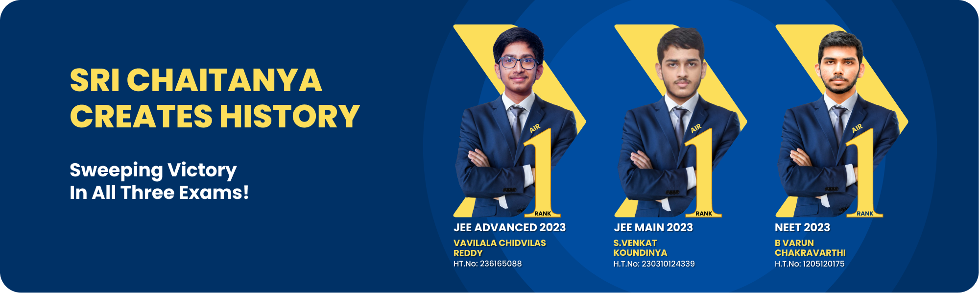
An Intiative by Sri Chaitanya

a

Jhelum and Sutlej

b

Ganga and Yamuna

c

Ghaggar and Teesta

d

Gomati and Krishna 

answer is C.

(Unlock A.I Detailed Solution for FREE)

Ready to Test Your Skills?

Check your Performance Today with our Free Mock Test used by Toppers!

Take Free Test

Detailed Solution

The Ganga Plain stretches between the Ghaggar river and the Teesta river. In India, the northern plains have been divided into three categories: the Ganga Plains, the Punjab Plains, and the Brahmaputra Plains. The greatest portion of the Northern Plain is known as the Ganga Plain. Quaternary alluvial with mixtures of clay, silt, sand, and gravel defines the Ganga Plain. It includes states from Punjab to Haryana, Delhi, UP, Bihar, and eastern states such as Jharkhand and West Bengal.
 
Watch 3-min video & get full concept clarity

Best Courses for You

JEE

JEE

NEET

NEET

Foundation JEE

Foundation JEE

Foundation NEET

Foundation NEET

CBSE

CBSE

score_test_img

Get Expert Academic Guidance – Connect with a Counselor Today!

whats app icon
Read the source given below and answer the question that follows.The Ganga Plain extends between Ghaggar and Teesta rivers. It is spread over the states of North India, Haryana, Delhi, U.P., Bihar, partly Jharkhand and West Bengal to its East, particularly in Assam lies the Brahmaputra plain. The northern plains are generally described as flat land with no variations in its relief. It is not true. These vast plains also have diverse relief features. According to the variations in relief features, the Northern plains can be divided into four regions. The rivers, after descending from the mountains, deposit pebbles in a narrow belt of about 8 to 16 km in width lying parallel to the slopes of the Shivalik. It is known as bhabar. All the streams disappear in this bhabar belt. South of this belt, the streams and rivers re-emerge and create a wet, swampy and marshy region known as terai. This was a thickly forested region full of wildlife. The forests have been cleared to create agricultural land and to settle migrants from Pakistan after partition. Dudhwa National Park is in this region.The Ganga Plain extends between which two rivers?