


Courses

By Brijesh Sharma
|
Updated on 27 Oct 2025, 17:41 IST
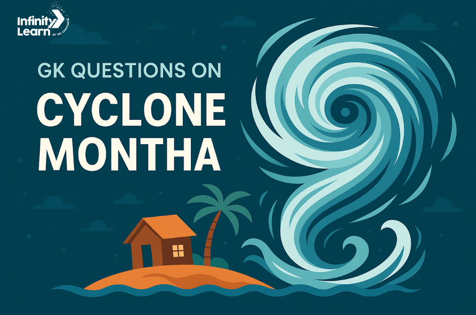
GK Questions on Cyclone Montha: Cyclone Montha is a tropical cyclone over the Bay of Bengal that is bringing heavy rain, strong winds, and coastal alerts across parts of Andhra Pradesh, Tamil Nadu, Odisha, and West Bengal, with Chennai facing intense showers and gusts as the system moves northwestward today and tomorrow. According to IMD bulletins and live trackers, Montha may intensify into a severe cyclonic storm before landfall near Kakinada on October 28, so preparedness, accurate information, and safe practices are very important for learners and families following daily updates.
This GK questions set covers: 50+ gk questions cyclone montha with Answers, cyclone Montha update, cyclone Montha West Bengal impact window, cyclone tracker basics, cyclone Montha Chennai rainfall pattern, cyclone live alerts meaning, and why Chennai rains become intense ahead of landfall, plus what “cyclone Montha today” really indicates in weather advisories. Students will also learn semantic ideas like warning levels (yellow/orange/red), landfall zone, wind speed bands, storm surge risk, and evacuation readiness. Keep checking official cyclone tracker maps and IMD messages for clear, up-to-date facts during this event.
Ques: When is Cyclone Montha expected to make landfall?
Ans: On the evening or night of 28 October 2025 between Machilipatnam and Kalingapatnam (around Kakinada) on the Andhra Pradesh coast.
Ques: What is the forecast maximum sustained wind speed near landfall?
Ans: ~ 90-100 km/h, gusts up to ~ 110 km/h.
Ques: Which states/governments have issued red alerts or started evacuations due to Montha?
Ans: The governments of Andhra Pradesh and Odisha have issued high alerts, evacuated tens of thousands of people.

Ques: What is the current location of Montha (as of early 27 October 2025)?
Ans: Roughly 12.2° N, 85.3° E; about 560 km east-southeast of Chennai, 620 km south-southeast of Kakinada.

JEE

NEET

Foundation JEE

Foundation NEET

CBSE
Ques: What direction and speed is Montha moving?
Ans: Moving northwestwards at ~ 15 km/h.
Ques: Which name country contributed the name “Montha” and what does it mean?
Ans: Thailand proposed the name; it means a “fragrant/beautiful flower”.
Ques: Which major hazards are expected from Montha along the coast?
Ans: Gale-force winds, very high seas, coastal flooding/erosion, extremely heavy rainfall.
Ques: Which states beyond Andhra and Odisha are under heavy rainfall alerts due to Montha’s influence?
Ans: Tamil Nadu, Kerala, Telangana, and coastal Karnataka are also under alerts.
Ques: Approximately how many people have been evacuated already in preparation for Montha?
Ans: About 50,000 people have been moved to relief camps.
Ques: What time of year (typical season) does the North Indian Ocean see cyclones like Montha?
Ans: The post-monsoon period, especially October-December, is one peak season.
Ques: What is the storm’s official name?
Ans: Cyclonic Storm Montha.
Ques: How is “Montha” pronounced?
Ans: “Mon‑Tha.”
Ques: Which ocean basin is Montha in?
Ans: The Bay of Bengal.
Ques: Which agency names North Indian Ocean cyclones?
Ans: IMD’s RSMC New Delhi.
Ques: At what wind does a storm get a name here?
Ans: 34 knots (≈62 km/h) sustained.
Ques: Who proposed the name “Montha”?
Ans: Thailand.
Ques: What does “Montha” mean?
Ans: A fragrant or beautiful flower (Thai origin).
Ques: Status as of 27 Oct 2025 (afternoon IST)?
Ans: Cyclonic Storm, expected to intensify.
Ques: Projected next category?
Ans: Severe Cyclonic Storm by morning of 28 Oct.
Ques: Expected landfall window and area?
Ans: Evening/night 28 Oct, Andhra Pradesh coast near Kakinada (between Machilipatnam and Kalingapatnam).
Ques: What is the official name of the cyclone approaching the Bay of Bengal in late October 2025?
Ans: The storm is officially named Cyclone Montha.
Ques: How do you pronounce the name “Montha” when referring to this cyclone?
Ans: It is pronounced “Mon-tha”.
Ques: In which ocean basin is Cyclone Montha developing?
Ans: It is developing in the Bay of Bengal (North Indian Ocean basin).
Ques: Which meteorological agency is responsible for naming cyclones in the North Indian Ocean region such as Montha?
Ans: The agency is the India Meteorological Department (IMD) acting as Regional Specialised Meteorological Centre (RSMC) for that region.
Ques: At what sustained wind speed does a tropical system in the North Indian Ocean receive a name?
Ans: A system is named once it reaches sustained winds of about 34 knots (≈62 km/h) or more.
Ques: Which country submitted the name “Montha” for the naming list of storms?
Ans: The name “Montha” was proposed by Thailand.
Ques: What is the meaning or origin of the name “Montha”?
Ans: “Montha” is derived from Thai language and refers to a fragrant or beautiful flower.
Ques: What was the status of Cyclone Montha as of 27 October 2025 afternoon IST?
Ans: As of that date, Montha had been designated as a Cyclonic Storm and was expected to intensify further.
Ques: What intensity category was Cyclone Montha forecast to reach by the morning of 28 October 2025?
Ans: It was forecast to intensify to a Severe Cyclonic Storm category.
Ques: When and where was the landfall of Cyclone Montha expected to occur along the Indian coast?
Ans: Landfall was expected on the evening or night of 28 October 2025, along the Andhra Pradesh coast near Kakinada (between Machilipatnam and Kalingapatnam).
Ques: What was the reported centre position of the storm at 0830 IST on 27 October 2025 (latitude & longitude)?
Ans: 12.6° N, 85.0° E.
Ques: Approximately how far was Montha’s centre from Chennai (Tamil Nadu) at that time?
Ans: Approximately 520 km east-southeast of Chennai.
Ques: How far was the storm’s centre from Kakinada (Andhra Pradesh) at that time?
Ans: Approximately 570 km south-southeast of Kakinada.
Ques: What was the distance between the storm’s centre and Visakhapatnam at that time?
Ans: About 600 km south-southeast of Visakhapatnam.
Ques: What was its distance from Gopalpur (Odisha) at that point in time?
Ans: ~750 km south of Gopalpur.
Ques: What was the distance from Port Blair (Andaman & Nicobar) at that time?
Ans: ~850 km west of Port Blair.
Ques: What was the movement speed and direction of Montha as reported then?
Ans: The storm was moving north-northwestward at about 18 km/h.
Ques: What was the forecasted track for Montha before landfall?
Ans: It was forecast to move north-northwestwards toward the Andhra coast.
Ques: What storm intensity was predicted for Montha at landfall?
Ans: It was predicted to make landfall as a Severe Cyclonic Storm.
Ques: What were the forecasted peak sustained wind speeds just before landfall?
Ans: Sustained winds of 90–100 km/h, gusting to 110 km/h.
Ques: What storm surge was expected along the Andhra coast at landfall?
Ans: A storm surge of about 1 metre above astronomical tide was expected over low-lying coastal Andhra & Yanam.
Ques: What sea conditions (state) were expected over the west-/north-west Bay of Bengal on 28–29 October?
Ans: “Very high” seas were expected during that period.
Ques: What sea state was forecast along coastal Andhra Pradesh & Yanam on 28 evening to early 29 October?
Ans: Very high seas along those coastal waters as well.
Ques: What winds were forecast for coastal Andhra & Yanam in the morning of 28 October?
Ans: Gale winds of 60–70 km/h with gusts up to 80 km/h.
Ques: What winds were marketed for the evening/early 29 October timeframe over coastal Andhra & Yanam?
Ans: Winds of 90–100 km/h, gusts of up to 110 km/h.
Ques: What winds were forecast for Odisha’s coast during 28 Oct evening/early 29 Oct?
Ans: Gale winds of 60–70 km/h, gusting up to 80 km/h.
Ques: What sea condition was forecast for the Odisha coast on 28–29 October?
Ans: “High” sea state, easing after early 29 October.
Ques: What sea state was expected along the West Bengal coast 28–29 October?
Ans: Sea state described as “Rough”.
Ques: What rainfall risk was warned for Coastal Andhra & Yanam during 27–29 October?
Ans: Extremely heavy rainfall at isolated places.
Ques: What was the rainfall risk for south Odisha on 28–29 October?
Ans: Extremely heavy rainfall at isolated places.
Ques: What rainfall risk was flagged for Chhattisgarh on 28 October?
Ans: Extremely heavy rainfall at isolated places.
Ques: What was the outlook for thunderstorms and gusty winds for coastal Andhra, Yanam and Rayalaseema for the next five days from 27 October?
Ans: Thunderstorms with lightning and gusty winds were likely.
Ques: What squall wind risk was noted for Chhattisgarh on 28 October?
Ans: Squalls of 60-70 km/h were possible.
Ques: What are the primary hazards listed by IMD for the coastal Andhra & Yanam region from Cyclone Montha?
Ans: The hazards include gale-force winds, storm surge, very high seas, and extremely heavy rainfall.
Ques: What kind of structural damage is likely according to IMD’s bulletin for this cyclone?
Ans: Major damage to thatched huts, metal roofs/roof sheets likely to blow off, and power lines may get damaged.
Ques: What coastal impact (besides wind and rain) is anticipated for north Andhra & Yanam?
Ans: Coastal flooding and erosion are anticipated in low-lying coastal areas.
Ques: What are the instructions for fishing vessels and fishermen for this cyclone event?
Ans: Fishermen are advised not to venture into the sea from 26 to 29 October along Tamil Nadu, Andhra Pradesh & Yanam, Odisha and West Bengal coasts. Those already at sea should return immediately.
Ques: What general advice is given to the public in affected coastal districts?
Ans: Coastal residents, especially hut dwellers, should be moved to safer places; people should stay indoors during adverse weather and avoid venturing outside during the storm.
Ques: Which government ministry oversees the India Meteorological Department?
Ans: The IMD is under the Ministry of Earth Sciences, Government of India.
Ques: Which major port-city is closest to the projected crossing point of Cyclone Montha?
Ans: The port-city is Kakinada, Andhra Pradesh.
Ques: What averaging period does the IMD use when it reports “sustained wind speed” for cyclones?
Ans: IMD uses a 3-minute average wind speed measured at 10 m height.
Ques: What wind-speed range defines a “Cyclonic Storm” according to IMD?
Ans: 34–47 knots (62–88 km/h).
Ques: What wind-speed range defines a “Severe Cyclonic Storm” (SCS) in the IMD system?
Ans: 48–63 knots (89–117 km/h).
Ques: What wind-speed range defines a “Very Severe Cyclonic Storm” (VSCS) in IMD terms?
Ans: 64–89 knots (118–166 km/h).
Ques: What range defines an “Extremely Severe Cyclonic Storm” (ESCS) by IMD?
Ans: 90–119 knots (167–221 km/h).
Ques: What is the threshold for a “Super Cyclonic Storm” in the IMD classification?
Ans: Equal to or greater than 120 knots (≥222 km/h).
Ques: How does IMD define “Very Heavy Rainfall” in 24 hours?
Ans: 115.6 to 204.4 mm in 24 hours.
Ques: How does IMD define “Extremely Heavy Rainfall” in 24 hours?
Ans: More than 204.5 mm in 24 hours.
Ques: What are the peak cyclone-season months in the North Indian Ocean?
Ans: The peak periods are April–May and October–December.
Ques: What is a “storm surge” according to IMD terminology?
Ans: A storm surge is the rise of sea level above the astronomical tide due to the combined effect of strong winds and low pressure (meteorological component).
Ques: What is the name of the cyclone currently developing in the Bay of Bengal that is being tracked by the India Meteorological Department (IMD), and what is its significance?
Ans: The cyclone is named Montha. It is significant because the IMD has issued multiple alerts for it as it is expected to intensify and impact the eastern coast of India.
Ques: How did Cyclone Montha originate, and what was the sequence of its development according to IMD bulletins?
Ans: Montha originated from a low-pressure area over the southeast Bay of Bengal, which then moved west-northwestwards. It was predicted to intensify into a depression by around 25 October, then into a deep depression by 26 October, and into a cyclonic storm (Montha) by the morning of 27 October.
Ques: Which parts of India are under alert due to Cyclone Montha and why?
Ans: Coastal districts of Andhra Pradesh, Tamil Nadu, Yanam (Union Territory of Puducherry), Odisha, and parts of Rayalaseema are under alert. This is because Montha is expected to bring heavy to very heavy/rainfall, strong winds and rough sea conditions.
Ques: What are the key rainfall/wind warnings issued by IMD for Cyclone Montha?
Ans: Key warnings include: heavy to very heavy rainfall over coastal Andhra Pradesh and Yanam; orange alerts (significant risk) for Chennai and nearby districts for very heavy rainfall and thunderstorms; strong surface winds likely over coastal Andhra and Yanam.
Ques: What is the forecasted track and landfall region of Cyclone Montha according to recent reports?
Ans: The forecasted track shows Montha moving west-northwestwards from the southeast Bay of Bengal toward the Andhra Pradesh coast. It is expected to make landfall between Machilipatnam and Kalingapatnam, near Kakinada in Andhra Pradesh.
Ques: What potential sea and marine conditions are being forecast along the coast due to Cyclone Montha?
Ans: Very high seas, gale to storm-force winds over the Bay of Bengal and adjoining coastal areas are expected. Fishermen have been advised not to venture into the sea until further notice.
Ques: What state of preparedness actions are being taken by authorities in regions threatened by Cyclone Montha?
Ans: Authorities are issuing red/orange alerts, evacuating low-lying coastal areas, telling fishermen to stay onshore, closing beaches and schools in threatened districts, and mobilising disaster response teams.
Ques: What is the time-frame in which Cyclone Montha is expected to intensify and make landfall?
Ans: The system was anticipated to become a cyclonic storm by the morning of 27 October, and a severe cyclonic storm by 28 October, with landfall expected in the evening/night of 28 October.
Ques: Why is the region of north-Tamil Nadu (including Chennai) under alert even though the landfall is forecast further south in Andhra Pradesh?
Ans: Because the peripheral impacts of Montha (heavy rainfall, thunderstorms, gusty winds) will affect coastal and nearby inland districts of Tamil Nadu as the system intensifies and moisture spreads.
Ques: What is the importance of the naming of Cyclone Montha and how are names decided in the North Indian Ocean?
Ans: Naming helps in clear communication and public awareness of the cyclone hazard. Names for cyclones in the North Indian Ocean are drawn from a pre-agreed list contributed by countries in the region. Montha was assigned from that list.
No courses found
Cyclone Montha is a tropical storm that developed over the southeast Bay of Bengal and is forecast to intensify before landfall near the Andhra coast around Kakinada area. It formed from a low-pressure area that strengthened due to warm sea temperatures and favorable wind conditions.
Landfall is expected on or around October 28 between Machilipatnam and Kalingapatnam near Kakinada, with alerts across Andhra Pradesh and Odisha; advisory impacts also extend to parts of Tamil Nadu and West Bengal. Schools and anganwadi centres are closed in several coastal districts during the warning period.
Chennai may see heavy to very heavy rainfall and strong winds as outer rainbands pass before and during the approach, even if the landfall is farther north along Andhra coast. Urban flooding risk rises when intense bands align with high runoff and poor drainage, so citizens should follow local advisories closely.
Use a reliable cyclone tracker and follow official IMD bulletins for “yellow, orange, red” alerts, wind-speed bands, and storm surge guidance; do not rely only on social media forwards. Check updates multiple times per day because cyclone tracks can shift by tens of kilometers.
Keep emergency kits ready, charge phones, avoid coastal travel, and follow evacuation orders from local authorities; fishermen should stay ashore during warnings. Share your location with relatives and use official helplines if you need assistance or shelter.