Cyclone Montha Explained: Naming, Categories, and Warning Colours
Cyclone Montha Explained: Naming, Categories, and Warning Colours
By Ankit Gupta
|
Updated on 27 Oct 2025, 17:20 IST
A new cyclonic storm named Cyclone Montha has formed over the Arabian Sea and is expected to make landfall near Kakinada, Andhra Pradesh, on October 28, according to the India Meteorological Department (IMD). The system is strengthening rapidly, with several coastal states—Andhra Pradesh, Odisha, and Tamil Nadu—under heavy-rain and wind warnings.
Fill out the form for expert academic guidance
What Is a Cyclone?
A cyclone is a large storm that spins around a low-pressure centre. It forms over warm ocean water when rising moist air creates clouds and winds that spiral inward. The combination of heat, moisture, and Earth’s rotation builds up huge energy.
When this system moves toward land, it brings heavy rain, strong winds, and high waves, often causing floods and damage.
Unlock the full solution & master the concept
Get a detailed solution and exclusive access to our masterclass to ensure you never miss a concept
Warm Sea Water – The ocean surface must be at least 26 °C or warmer.
Moist Air – Hot, humid air rises and cools, forming clouds.
Rotation of the Earth – The Earth’s spin causes the air to rotate around the low-pressure centre.
No Wind Disturbance Above – If strong upper winds don’t tear it apart, the system strengthens.
Once these conditions are right, a low-pressure area becomes a depression, then a deep depression, and finally a cyclonic storm when wind speeds reach around 62 km/h or more.
Ready to Test Your Skills?
Check Your Performance Today with our Free Mock Tests used by Toppers!
Take Free Test
Why Do Cyclones Have Names?
Naming storms helps everyone talk about the same system without confusion. Instead of saying “the storm in the Bay of Bengal,” it’s easier to say “Cyclone Montha.” Names make weather warnings clear and short.
The IMD (India Meteorological Department) gives names to storms in the North Indian Ocean.
Countries like India, Bangladesh, Oman, Sri Lanka, Myanmar, Thailand, Maldives, Iran, Qatar, Saudi Arabia, UAE, Yemen, and Pakistan submit name lists.
Each country offers 13 names, forming a total pool of 169.
When a new cyclone forms, the next unused name is picked in order. “Montha” was next on the list when this storm appeared.
create your own test
YOUR TOPIC, YOUR DIFFICULTY, YOUR PACE
start learning for free
Meaning of the Name Montha
The word “Montha” was suggested by Thailand. In the Thai language, it means “fragrant flower” or “beautiful flower.” The name does not represent the storm’s intensity or danger; it’s just part of the rotating list used by the regional meteorological centre.
Cyclone Montha’s Current Situation
According to the IMD cyclone tracker, the storm formed over the Arabian Sea and moved toward the Bay of Bengal. It is currently moving north-westwards toward the Andhra Pradesh coast, where it is expected to make landfall between Machilipatnam and Kalingapatnam, near Kakinada, on October 28 evening.
Best Courses for You
JEE
NEET
Foundation JEE
Foundation NEET
CBSE
Wind speed: 90–100 km/h (gusting up to 110 km/h)
Rainfall: Very heavy to extremely heavy in coastal Andhra Pradesh, south Odisha, and parts of north Tamil Nadu
Sea condition: Rough to very rough; fishermen warned not to venture out
Storm surge: Around 1 metre above normal tide expected near landfall
Coastal Andhra Pradesh will see extremely heavy rainfall. The storm will likely make landfall near Kakinada, where winds could touch 100 km/h. Low-lying villages along the Godavari and Krishna rivers face a flood risk.
b) Odisha
South Odisha districts will get rain on October 28–29. Even if the centre of the storm is far away, the outer bands can cause flash floods and landslides.
c) Tamil Nadu and Chennai
Chennai and nearby coastal districts may experience heavy showers and gusty winds. Local schools could remain closed depending on the forecast. Check Chennai school news today or the district website for official updates.
What to Do During the Cyclone
When a cyclone like Montha arrives, the biggest mistake people make is stepping outside or underestimating the danger. Even if winds don’t seem strong at first, they can rise suddenly. Here’s how to stay safe when the storm hits:
Stay Indoors: Remain inside a strong building. Keep doors and windows tightly closed. Move to a central room with no windows, such as a bathroom or hallway. Avoid glass windows that could break under strong pressure.
Turn Off Electricity: Before the storm reaches full strength, turn off electric appliances and unplug devices. This helps prevent short circuits or electrical fires if power lines fall or water enters your home.
Avoid Open Flames: Do not light candles or stoves if you suspect a gas leak. Use battery torches instead. Even a small spark can cause a fire or explosion if gas has leaked during strong winds.
Stay Away from Windows and Doors: Flying debris—like roof tiles or metal sheets—can hit windows. Stay in a safe room away from glass. Close curtains or cover windows with thick cloth to stop flying shards if they break.
Don’t Step Outside: Even if the wind calms suddenly, stay indoors. The quiet might be the “eye” of the cyclone—calm in the centre, but deadly winds return within minutes from the opposite direction. Wait until the authorities give the all-clear.
Keep Calm and Stay Updated: Use radio, phone alerts, or TV to get official weather updates. If the network fails, rely on battery radios. Don’t spread rumours—trust the IMD or local government announcements.
What to Do After the Cyclone
After the cyclone passes, the danger is not over. Flooding, broken wires, and damaged buildings can still harm people. Follow these safety steps carefully.
Wait for Official Clearance: Do not rush outdoors as soon as winds stop. The IMD and local officials will declare when it’s safe to move. Going out early can expose you to falling trees, live wires, or unstable roofs.
Avoid Flooded Streets: Never walk or drive through floodwater. Even ankle-deep water may hide open drains or sharp objects. Moving water can sweep people away easily. Wait for water to recede before travelling.
Stay Away from Electric Wires: Broken power lines are extremely dangerous. Stay at least 10 metres away. Inform local authorities if you see one. Do not try to move or touch cables yourself.
Use Phones Wisely: Send text messages instead of making long calls. Texts use less battery and network space, helping emergency teams work efficiently. Save your power for updates or emergencies.
Help Others: Check on elderly neighbours, children, and those needing medical help. Share food and water if you can. Report serious damage to local disaster teams or the police.
Water and Hygiene: Avoid drinking tap water until it’s officially declared safe. Boil water before use or rely on sealed bottles. Floodwater may contaminate local supply lines, increasing the risk of disease.
Why Cyclones Hit This Region Often
The east coast of India—especially Andhra Pradesh and Odisha—faces frequent cyclones due to unique geography and climate.
Warm Bay of Bengal: The Bay of Bengal stays warm for most of the year, often above 28°C. Warm water acts as fuel for cyclones, giving them energy to grow rapidly.
Funnel-Shaped Coast: The coast of eastern India narrows like a funnel. This shape pushes rising sea water inward during a cyclone, creating a storm surge—a sudden rise in sea level that floods coastal towns.
Post-Monsoon Weather: Between October and December, sea temperatures are high, winds are calmer, and the air is humid—perfect conditions for cyclone formation. That’s why this is known as the cyclone season.
History of Storms: Andhra Pradesh and Odisha typically face two to three cyclones every year. Some are weak, but others, like Phailin (2013) and Hudhud (2014), caused major destruction. Montha fits this seasonal pattern.
To reduce damage, governments in Andhra Pradesh, Odisha, and Tamil Nadu began preparing days before Montha’s landfall.
Disaster Teams on Alert: The National Disaster Response Force (NDRF) and State Disaster Response Force (SDRF) have deployed rescue teams with boats, ropes, and medical kits. Their job is to evacuate people, rescue trapped families, and clear debris.
Relief Shelters and Food Supplies: Local administrations have opened cyclone shelters and community halls stocked with dry food, water, and medicines. These are safe spaces for those evacuated from coastal villages.
Temporary Shelters: Schools and community halls have been converted into temporary relief centres. Students’ safety is prioritized, and classes are suspended until conditions normalize.
Transport and Fishing Ban: Fishing operations are suspended across the Bay of Bengal and nearby seas. Ports remain closed to prevent damage to boats. Bus and train services near coastal towns are on hold until landfall passes.
Power and Telecom Response: Power supply departments have emergency repair teams on standby to fix snapped wires or poles. Telecom networks are preparing mobile towers with backup generators.
Evacuation Efforts: Tens of thousands of people in low-lying areas are being moved to higher ground. Officials are ensuring food and clean water reach these shelters.
Fishermen and Coastal Community Advisory: Fishermen and coastal residents are at the highest risk during cyclones like Montha. The IMD has issued strict guidelines to protect lives and equipment.
Fishermen Advisory
Do not venture into the sea until IMD lifts the warning.
Return to port immediately if already at sea.
Keep boats anchored or pulled ashore well above high tide.
Secure fishing nets and engines to prevent loss.
Coastal Residents
Stay away from beaches, piers, and seawalls.
Move livestock and pets to higher ground.
Obey evacuation orders quickly; do not wait until the last minute.
Coastal areas face storm surges—sudden rises in sea level—that can sweep away small boats, huts, and vehicles. Following port authority instructions can be life-saving.
Role of Technology in Tracking Montha
Modern technology allows meteorologists to predict a cyclone’s path days in advance, helping authorities prepare.
Satellites: The INSAT-3D and INSAT-3DR satellites monitor sea-surface temperature, cloud movement, and humidity. They provide real-time pictures every 15 minutes, showing how the storm is evolving.
Doppler Weather Radars: Installed along India’s coast, these radars measure wind speed and rainfall intensity. They track the cyclone’s exact position and help predict landfall timing with high accuracy.
Automatic Weather Stations and Ocean Buoys: Hundreds of automatic sensors and floating buoys collect data on air pressure, wind speed, and sea temperature. This information feeds into computer models to refine forecasts.
Numerical Forecast Models: Advanced computer simulations like GFS, WRF, and ECMWF use mathematical equations to model how Montha will move and strengthen. These forecasts are continuously updated with new satellite data.
Public Access: Anyone can track Cyclone Montha Live on the IMD’s official website or weather apps like Windy or Earth.nullschool. These platforms show live maps, wind speeds, and pressure systems in simple visuals.
Climate Context: Cyclones have always been part of the Indian Ocean’s natural weather cycle. However, recent patterns show they are becoming more intense due to climate change.
Warmer Oceans = Stronger Storms: The world’s oceans are getting warmer because of global warming. Warm water feeds cyclones with energy, helping them strengthen faster. A system that used to take four days to intensify may now reach dangerous levels in just one or two.
Faster Intensification: Meteorologists have observed that recent cyclones like Amphan (2020), Tauktae (2021), and now Montha intensify much more quickly than storms 30 years ago. This makes early warning crucial.
Heavier Rainfall: Hotter air holds more moisture, leading to extremely heavy rain even far from the cyclone’s centre. This causes inland flooding hundreds of kilometres away from landfall zones.
Not More Frequent, But More Powerful: Climate change doesn’t mean there will be more cyclones every year—but the ones that do form are likely to be stronger, wetter, and faster.
Cyclone Montha reminds us how nature’s power can test preparedness and community strength. While technology and government readiness have improved, safety ultimately depends on how well people follow warnings.
If you live in an affected district, follow three golden rules:
Stay informed through IMD and official channels.
Stay indoors during the storm.
Stay patient after it passes—safety first, not speed.
course
No courses found
FAQs on Cyclone Montha
What is Cyclone Montha?
Cyclone Montha is a severe cyclonic storm formed over the Arabian Sea that is moving toward the Andhra Pradesh coast, expected to make landfall near Kakinada around October 28.
Where did Cyclone Montha form?
It formed over the Arabian Sea and later moved toward the Bay of Bengal, gaining strength as it approached India’s eastern coast.
When will Cyclone Montha make landfall?
The India Meteorological Department (IMD) predicts landfall between Machilipatnam and Kalingapatnam, near Kakinada, on the evening or night of October 28.
How strong is Cyclone Montha expected to be?
Montha is likely to reach the level of a Severe Cyclonic Storm, with wind speeds of 90–100 km/h, gusting up to 110 km/h.
Which areas are under red alert?
Red alerts have been issued for coastal Andhra Pradesh districts like Kakinada, Konaseema, Krishna, Nellore, Bapatla, Prakasam, and parts of East and West Godavari.
Why is the cyclone named “Montha”?
“Montha” was suggested by Thailand and means “fragrant flower” or “beautiful flower” in the Thai language.
Who names cyclones in this region?
Cyclones in the North Indian Ocean are named by the IMD, using a list of names submitted by 13 countries, including India, Bangladesh, Oman, Sri Lanka, and Thailand.
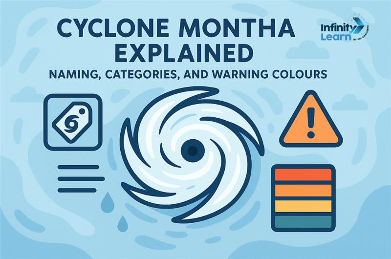
What are the warning colours used by IMD?
IMD uses four colours:
Green: No warning
Yellow: Be aware
Orange: Be prepared
Red: Take action
What should people do during a cyclone?
Stay indoors with doors and windows shut. Turn off electricity, avoid open flames, stay away from glass, and listen to official updates through radio or phone alerts.
What should be done after the cyclone passes?
Wait for the official all-clear, avoid floodwaters, stay away from electric wires, use messages to save phone battery, and drink only clean or boiled water.
Why do Andhra Pradesh and Odisha get cyclones often?
These states face cyclones often because the Bay of Bengal is warm year-round, and its funnel-shaped coast intensifies storm surges during October to December.
How are authorities preparing for Cyclone Montha?
State governments have deployed disaster response teams, opened relief shelters, closed schools, suspended fishing, and kept power and telecom teams ready for quick recovery.
What are the IMD’s instructions for fishermen?
Fishermen have been told not to venture into the sea until further notice. Boats must be secured on high ground, and crews should follow port authority directions.
How does the IMD track Cyclone Montha?
IMD uses INSAT-3D/3DR satellites, Doppler weather radars, automatic weather stations, and numerical forecast models to predict the cyclone’s path and strength.
How is climate change linked to stronger cyclones?
Climate change warms the ocean, giving storms more energy. As a result, cyclones intensify faster, bring heavier rainfall, and cause greater flooding — even if their number doesn’t increase.