


Courses

By Karan Singh Bisht
|
Updated on 11 Jun 2026, 12:58 IST
The NCERT Solutions for Class 6 Social Science, India and the World - Land and the People, Chapter 1 Locating Places on the Earth available on Infinity Learn, help students understand how to locate places on a globe or map. This chapter introduces important geography concepts such as latitudes, longitudes, the Equator, the Prime Meridian, and time zones. It explains how these imaginary lines help identify the exact position of any place on Earth and make maps easier to read and understand.
Through Infinity Learn NCERT Solutions for Class 6 Social Science, students can learn these concepts in a simple and student-friendly way. The NCERT solutions also help students answer textbook questions with clarity and build a strong foundation for higher-level geography studies. This chapter encourages curiosity about maps and globes and helps students understand how these tools are useful in everyday life for exploring the world around them.
Locating Places on the Earth Class 6th Question Answer helps students understand the basic concepts of geography in a simple way. In Locating Places on Earth Class 6 NCERT, students learn how latitudes and longitudes are used to locate any place on Earth. The chapter also explains important topics like the Equator, Prime Meridian, heat zones, and time differences across the world.
With Locating places on the earth NCERT solutions class 6 questions, students can revise textbook answers easily and prepare well for school exams. These solutions make Locating Places on the Earth Question Answer simple, clear, and easy to understand.
Students can also use Locating Places on Earth Class 6 Question Answer PDF for quick revision anytime. For better practice, Locating Places on Earth Class 6 extra questions and answers and Locating Places on Earth Class 6 Worksheet are helpful for improving understanding, writing skills, and exam confidence.
Overall, this chapter builds a strong foundation in geography and helps students connect map-reading concepts with real-world examples.
Loading PDF...
1. What is a map?
Answer: A map is a drawing or representation of an area on a flat surface. It can show a small area like a village or town, a bigger area like a state or country, or even the whole world. A map helps us understand where places are located and how we can reach them. For example, if we visit a new city, a map can help us find a railway station, school, hospital, market, museum or bank.
2. How is a map useful to us?
Answer: A map is useful because it helps us find places, understand directions and know the distance between two locations. It works like a guide. If we do not know the way to a place, we can use a map to decide which road to take. Maps are also useful for students, travellers, pilots, sailors, drivers and people who study geography.

3. What are the main components of a map?
Answer: The three main components of a map are distance, direction and symbols. Distance helps us understand how far one place is from another. Direction tells us where a place is located, such as north, south, east or west. Symbols are small signs or drawings used to show features like roads, rivers, railway stations, schools, post offices and temples.

JEE

NEET

Foundation JEE

Foundation NEET

CBSE
4. What is a scale on a map?
Answer: A scale shows the relationship between the distance on a map and the actual distance on the ground. Since large areas cannot be shown in their real size on paper, maps are drawn smaller. For example, if the scale is 1 cm = 500 m, it means 1 cm on the map represents 500 metres on the ground. This helps us calculate real distances using a map.
5. What are cardinal directions?
Answer: The four main directions are called cardinal directions. They are North, South, East and West. These directions help us understand the position of one place in relation to another. Most maps show an arrow marked “N”, which points towards the north direction.
6. What are intermediate directions?
Answer: Intermediate directions are the directions between the four cardinal directions. They are Northeast, Southeast, Southwest and Northwest. These directions help us describe locations more accurately. For example, if a museum is between south and east from a bank, we say it is southeast of the bank.
7. Why do we need symbols and colours on a map?
Answer: Symbols and colours are needed because a map has limited space. It is not possible to draw every building, road, river or forest in detail. So, map makers use symbols to represent different features. For example, a line may show a road, a blue colour may show water, and a small sign may show a railway station. Colours and symbols make maps easy to read and understand.
8. What is an atlas?
Answer: An atlas is a book or collection of maps. It may contain maps of countries, states, continents, oceans and the world. Students use an atlas to study locations, boundaries, rivers, mountains, cities and other geographical features.
9. What are physical maps?
Answer: Physical maps are maps that show natural features of the Earth. These include mountains, rivers, oceans, deserts, plateaus and plains. Physical maps help us understand the natural surface of the Earth.
10. What are political maps?
Answer: Political maps show countries, states, union territories, cities, capitals and boundaries. For example, a political map of India shows different states, union territories and their capitals. These maps help us understand political divisions.
11. What are thematic maps?
Answer: Thematic maps show specific information about a place or region. For example, a thematic map may show rainfall, population, crops, forests, minerals, industries or languages. These maps focus on one particular theme or topic.
12. What is a globe?
Answer: A globe is a spherical model of the Earth. Since the Earth is nearly spherical, a globe represents the Earth more accurately than a flat map. It shows continents, oceans, countries and imaginary lines like latitudes and longitudes.
13. Why is it difficult to show the Earth accurately on a flat map?
Answer: The Earth is nearly spherical, not flat. When we try to show a round object on a flat sheet of paper, some distortion takes place. For example, if we peel an orange and try to flatten its peel, it may tear or lose its proper shape. Similarly, a flat map cannot show the Earth perfectly, but a globe can represent it more accurately.
14. What are coordinates?
Answer: Coordinates are a system used to locate a place exactly. Just as a chessboard uses letters and numbers to identify each square, maps use latitude and longitude to find the exact position of a place on Earth. Latitude and longitude together act as the coordinates of a place.
15. What is latitude?
Answer: Latitude is the distance of a place from the Equator. It is measured in degrees. Latitudes are imaginary lines that run east to west and are parallel to the Equator. The Equator is marked as 0° latitude. The North Pole is 90°N and the South Pole is 90°S.
16. What is the Equator?
Answer: The Equator is an imaginary line that divides the Earth into two equal halves: the Northern Hemisphere and the Southern Hemisphere. It is the longest parallel of latitude and is marked as 0°. Places near the Equator usually have a hot climate.
17. What are parallels of latitude?
Answer: Parallels of latitude are imaginary circles drawn around the Earth parallel to the Equator. These circles become smaller as we move towards the North Pole or South Pole. The Equator is the largest parallel of latitude.
18. How is latitude related to climate?
Answer: Latitude affects the climate of a place. Places near the Equator receive more direct sunlight and are generally hot. This region is called the torrid zone. As we move away from the Equator towards the poles, the climate becomes cooler. Near the poles, the climate is very cold and is called frigid.
19. What is longitude?
Answer: Longitude is the distance of a place from the Prime Meridian. Longitudes are imaginary lines that run from the North Pole to the South Pole. These lines are also called meridians of longitude. They help us locate places east or west of the Prime Meridian.
20. What is the Prime Meridian?
Answer: The Prime Meridian is the 0° longitude line. It passes through Greenwich in London. It is used as the starting point for measuring longitudes. Places to the east of the Prime Meridian are marked with E, and places to the west are marked with W.
21. How do latitude and longitude help in locating places?
Answer: Latitude and longitude together help us find the exact location of any place on Earth. Latitude tells us how far a place is north or south of the Equator. Longitude tells us how far a place is east or west of the Prime Meridian. For example, Delhi is located around 29°N latitude and 77°E longitude.
22. What are grid lines?
Answer: The network formed by latitudes and longitudes on a globe or map is called a grid. These lines are known as grid lines. Grid lines help us locate places accurately on the Earth.
23. How is longitude related to time?
Answer: Longitude is closely related to time because the Earth rotates from west to east. As a result, different places receive sunlight at different times. When it is morning in one part of the world, it may be afternoon, evening or night in another part. Therefore, by knowing the longitude of a place, we can calculate its local time.
24. What is local time?
Answer: Local time is the time of a particular place based on its longitude. Places located on different longitudes have different local times. For example, Assam is located towards the east of Gujarat, so the sun rises and sets earlier in Assam than in Gujarat.
25. What is standard time?
Answer: Standard time is the common time followed by a country or region. If every city followed its own local time, it would create confusion in train timings, school timings, office work and communication. So, countries choose one standard meridian and follow the time based on that meridian.
26. What is Indian Standard Time?
Answer: Indian Standard Time, or IST, is the standard time followed in India. It is 5 hours and 30 minutes ahead of Greenwich Mean Time. This means when it is 12 noon in London, it is 5:30 pm in India.
27. Why is it 5:30 pm in India when it is 12 noon in London?
Answer: India lies to the east of Greenwich. The Earth rotates from west to east, so places to the east of Greenwich are ahead in time. Indian Standard Time is 5 hours and 30 minutes ahead of Greenwich Mean Time. Therefore, when it is 12 noon in London, it is 5:30 pm in India.
28. What is the difference between local time and standard time?
Answer: Local time is the time of a particular place according to its longitude. It can differ from place to place within the same country. Standard time is the common time followed by the whole country or a large region. For example, Gujarat and Assam have different local times because they are located at different longitudes, but both follow Indian Standard Time.
29. Why does the sun set earlier in Assam than in Gujarat?
Answer: Assam is located towards the east of Gujarat. Since the Earth rotates from west to east, eastern places receive sunlight earlier than western places. Therefore, sunrise and sunset happen earlier in Assam. This is why it may become dark in Assam while there is still daylight in Gujarat.
30. Delhi and Bengaluru have almost the same longitude, 77°E. How much will be the difference in their local time?
Answer: There will be almost no difference in local time between Delhi and Bengaluru because both cities are located near the same longitude, 77°E. Local time depends mainly on longitude, not latitude. Since their longitudes are almost the same, their local time will also be almost the same.
31. What are time zones?
Answer: Time zones are regions of the world that follow the same standard time. The Earth is divided into different time zones because different parts of the world experience day and night at different times. Time zones help countries maintain a uniform time system.
32. What is the International Date Line?
Answer: The International Date Line is an imaginary line located approximately at 180° longitude, opposite the Prime Meridian. When a person crosses this line, the date changes by one day. It is not completely straight because it bends in some places to avoid dividing countries into two different dates.
33. What happens when we cross the International Date Line?
Answer: When we cross the International Date Line travelling eastward, we subtract one day. When we cross it travelling westward, we add one day. This helps maintain the correct calendar date across the world.
1. Returning to page 10 and to Fig. 5.2 in Chapter 5 of this textbook, taking the scale to be 2.5 cm = 500 km, calculate the real distance from the estuary of the Narmada River to the estuary of the Ganga river. (Hint: round off your measurement on the map to an easy number.)
Answer: The distance between the estuaries of the Narmada and Ganga rivers is shown as 10 cm on the map. Since 2.5 cm on the map represents 500 km on the ground, 10 cm will represent four times 500 km. Therefore, the actual distance between the two estuaries is 2,000 km.
2. Why is it 5:30 pm in India when it is 12 pm or noon in London?
Answer: It is 5:30 pm in India when it is 12:00 noon in London because India is located east of London. London lies on the Prime Meridian, which is 0° longitude, while Indian Standard Time is based on the 82.5°E longitude.
The Earth takes 4 minutes to cover each degree of longitude. So, the time difference between London and India is calculated as:
82.5 × 4 minutes = 330 minutes
330 minutes is equal to 5 hours and 30 minutes. Therefore, India is 5 hours and 30 minutes ahead of London, which means when it is 12:00 noon in London, it is 5:30 pm in India.
3. Why do we need symbols and colours in the map?
Answer: Symbols and colours are very important in maps because they help represent different features clearly in a limited space. It is not possible to show the actual shapes and sizes of buildings, roads, temples, rivers, mountains and other features on a map. Therefore, map makers use specific symbols and colours to show these details in a simple way.
These symbols and colours make maps easy to read and understand. They also help people from different languages understand the same map, as symbols work like a universal language. Such commonly accepted symbols are called conventional symbols. In India, the Survey of India, a government body, has standardized these symbols for use in maps.
4. Find out what you have in the eight directions from your home or school.
Answer. The location I'm taking for this is my home
5. What is the difference between local time and standard time? Discuss it in groups, with each group writing an answer in 100 to 150 words. Compare the answers.
Answer. Local time is the time followed at a particular place based on the position of the Sun. It changes from one place to another because different locations lie on different longitudes. As the Earth rotates, the Sun appears overhead at different times in different places, so noon does not occur everywhere at the same time.
Standard time is the common time followed by an entire country or region. It is usually based on a selected central longitude, called the standard meridian. This system helps avoid confusion that would occur if every place followed its own local time. For example, India follows Indian Standard Time, which is based on the 82.5°E longitude.
In simple words, local time differs according to longitude, while standard time provides one uniform time for a larger area, making travel, communication, school timings and daily schedules easier to manage.
6. Delhi’s and Bengaluru’s latitudes are 29°N and 13°N; their longitudes are almost the same, 77°E. How much will be the difference in local time between the two cities?
Answer. Since Delhi and Bengaluru are located almost on the same longitude, around 77°E, there will be no major difference in their local time. Local time depends on longitude, not latitude. Therefore, places that lie on nearly the same meridian experience almost the same local time.
Although Delhi is located at about 29°N latitude and Bengaluru at about 13°N latitude, this difference does not affect their local time. Latitude mainly influences climate, temperature, and daylight conditions. Since both cities have nearly the same longitude, their local time will remain almost identical, with only a very small or negligible difference.
7. Mark the following statements as true or false; explain your answers with a sentence or two.
A. All parallels of latitude have the same length
Answer: False. Parallels of latitude are not equal in length. The Equator is the longest parallel, and the length of the parallels decreases as we move towards the poles.
B. The length of a meridian of longitude is half of that of the Equator.
Answer: True. A meridian of longitude is a half-circle running from the North Pole to the South Pole, while the Equator is a full circle around the Earth. Therefore, a meridian is half the length of the Equator.
C. The South Pole has a latitude of 90°S.
Answer: True. The South Pole is located at the southernmost point of the Earth, which corresponds to 90°S latitude
D. In Assam, the local time and the IST are identical.
Answer: False. Assam lies to the east of India’s standard meridian, so its local time is ahead of Indian Standard Time by a few minutes.
E. Lines separating the time zones are identical with meridians of longitude.
Answer: False. Time zones are based on meridians of longitude, but their boundaries are often adjusted according to countries and regions. So, they do not always follow meridians exactly.
F. The Equator is also a parallel of latitude.
Answer: True. The Equator is the largest parallel of latitude. It is marked as 0° latitude and divides the Earth into the Northern and Southern Hemispheres.
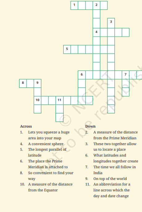
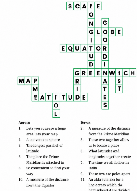
8. Solve the crossword below.
Answer:
Chapter 1 Locating Places on the Earth explains how we can find and mark the exact location of any place on a globe or map. The chapter introduces important geographical tools such as latitudes, longitudes, the grid system, and the Prime Meridian. A globe is a small model of the Earth. It helps us study continents, oceans, countries, and different locations more clearly because it shows the Earth in its spherical shape.
Latitudes and longitudes are imaginary lines drawn on the globe. Latitudes run from east to west and are parallel to the Equator. Important latitudes include the Equator, Tropic of Cancer, and Tropic of Capricorn. Longitudes run from the North Pole to the South Pole. The Prime Meridian, marked as 0° longitude, divides the Earth into the Eastern and Western Hemispheres.
Together, latitudes and longitudes form a grid system. This grid helps us locate any place on Earth accurately. Longitudes are also important for calculating time differences across the world, with the Prime Meridian at Greenwich used as the main reference point. Overall, this chapter helps students understand the importance of location in geography, navigation, map reading, and global communication.
| S.No. | NCERT Solutions for Class 6 |
| 1 | NCERT Solutions for Class 6 Maths |
| 3 | NCERT Solutions for Class 6 Social Science |
| 4 | NCERT Solutions for Class 6 English |
| 5 | NCERT Solutions for Class 6 Hindi |
No courses found
Locating Places on the Earth Class 6th Question Answer covers important topics such as maps, globes, directions, symbols, latitudes, longitudes, the Equator, Prime Meridian, grid system, local time, standard time, and Indian Standard Time. These answers help students understand how places are located accurately on the Earth.
Locating places on Earth Class 6 NCERT solutions are important because they explain the chapter in a simple and step-by-step manner. These solutions help students understand textbook questions clearly and prepare better for school exams, class tests, and homework.
Locating places on the earth NCERT solutions class 6 questions explain how maps and globes are used to find places. They also teach students how latitudes and longitudes form a grid system that helps locate any place on Earth accurately.
Students can use Locating Places on the Earth Question Answer for quick revision before exams. These answers help them revise key concepts like map components, coordinates, Prime Meridian, Equator, time zones, and International Date Line in an easy-to-understand format.
Locating Places on Earth Class 6 Question Answer PDF is useful for students who want to revise anytime. A Locating Places on Earth Class 6 PDF allows students to study important questions, textbook answers, and chapter summaries offline for better exam preparation.
Locating Places on Earth Class 6 extra questions and answers help students practice beyond textbook questions. A Locating Places on Earth Class 6 Worksheet is also helpful for improving map-reading skills, understanding directions, and gaining confidence in answering exam-based questions.
Students can find NCERT Solutions Class 6 Social Science Chapter 1 PDF on Infinity Learn for easy and quick revision. These solutions explain the chapter in simple language and help students understand important geography concepts like maps, globes, latitudes, longitudes, and directions.
The Social Science Class 6 Chapter 1 Question Answer PDF helps students revise textbook questions before exams. On Infinity Learn, students can use these answers to understand concepts clearly, improve answer-writing skills, and prepare better for school tests.
Yes, students can use NCERT Solutions Class 6 Social Science Chapter 1 PDF download resources on Infinity Learn to study anytime. The PDF format makes it easy to revise the chapter offline and go through important questions whenever needed.
The Class 6 Social Science Chapter 1 PDF covers the chapter Locating Places on the Earth. Infinity Learn NCERT Solutions Class 6 Social Science Chapter 1 Geography explain key topics such as map components, symbols, scale, directions, latitude, longitude, Prime Meridian, Equator, and standard time in a student-friendly way.