Table of Contents
Any one of several large geographic regions can be considered a continent. Generally speaking, the convention is used to identify continents rather than rigid standards. A continent might consist of a single landmass or, as in the cases of Asia and Europe, a portion of a very large landmass. As a result, there are different numbers of continents; four or seven distinct geographic regions are sometimes recognized as continents.
Also Check: Indian Ocean
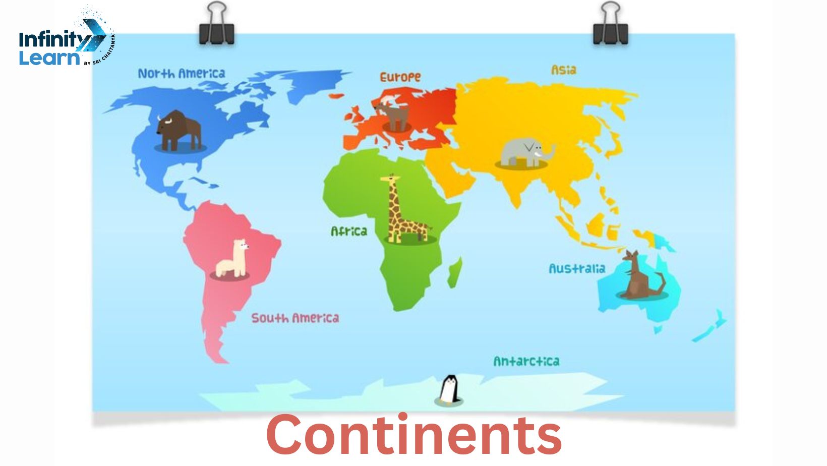
Map of Continents
Seven locations are recognized as continents by the majority of English-speaking nations. These seven regions include Asia, Africa, North America, South America, Antarctica, Europe, and Australia, arranged from largest to smallest in area. Some of these regions are merged into different forms with fewer continents; examples of this are the fusion of Asia and Europe into Eurasia, Africa, and North and South America into America.
To download the map of the continents of the world, click here
Map of Continents

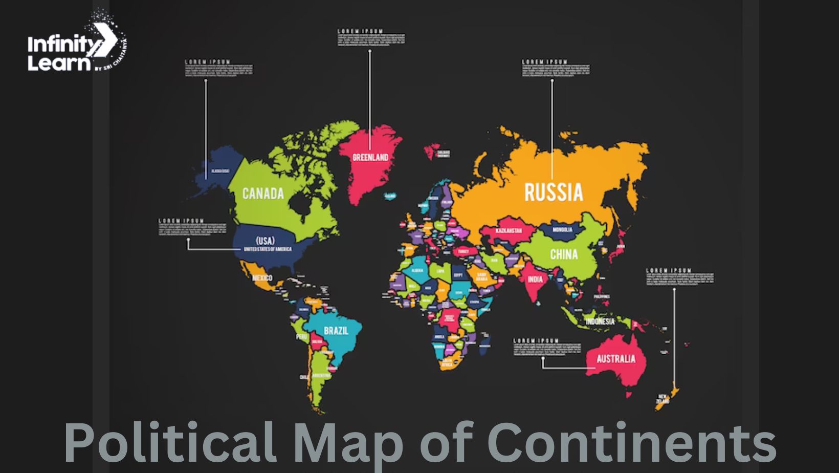
Political Map of Continents

Physical Map of Continents
Now and again, oceanic islands are combined with a nearby continent to create geographical zones that include the entirety of the planet. This plan groups the continent of Australia and the majority of the island nations and territories in the Pacific Ocean to create the geographical region known as Ocean
“One of Earth’s major land masses, including both dry land and continental shelves” is the definition of a continent in geology. The seven major regions of continental crust that are located on tectonic plates that make up the geological continents are separated from smaller, so-called microcontinents, like Madagascar, by tiny continental fragments. Only Earth is known to have a continental crust.
In the 20th century, continental drift became widely accepted. According to this theory, hundreds of millions of years ago, a supercontinent called Pangea broke apart to generate the current continents.
7 Continents of the World
The term “continent” refers to the vast land masses that make up the Earth. which oceans may or may not separate. From a geographical standpoint, or more accurately, continents are distinguished by the rocks that comprise them. These continents are further separated into many island nations. Asia, Africa, Europe, North America, South America, Australia, and Antarctica are the seven continents that make up our globe. The size and population of these seven continents vary
Continent of Asia
The largest continent in the world, accounting for one-third of the planet’s surface area, or nearly 30% of its overall size. It has its home in the Eastern Hemisphere. The map depicts the 48 United Nations-recognized countries, as well as a few dependent countries and extra areas. The continent’s overall population, including China and India, the world’s two most populous countries, is estimated to be 4,641,054,775. Many religions, including Buddhism, Islam, and Hinduism, began there. Asia is comprised of 48 countries. They are often classified into five regions: East Asia, Southeast Asia, South Asia, South-West Asia, and Central Asia.
Continent of Africa
Africa accounts for approximately 20% of the Earth’s landmass. The continent with the second-largest population in the globe is home to 1,340,598,147 people. Africa is made up of 54 countries. The Nile, the world’s longest river, originates there. Africa is also home to the world’s largest desert, the Sahara. Because the equator runs across the center of Africa, it receives direct sunlight all year. Ethiopia is the world’s hottest place which is located in Africa. Africa currently has 54 autonomous nations, the majority of which were created during European colonization.
Continent of Europe
With 44 countries and a population of nearly 747,636,026 people, Europe is a continent. Europe is the only continent that lacks deserts. The two world wars were mostly centered on Europe. Vatican City, the smallest nation on Earth, is located in Europe. Most European countries use the Euro as their sole currency. Germany is Europe’s most populous nation, with London and Paris as its most populous cities. There are fifty countries in Europe. Europe has forty-four sovereign states or nations, according to the traditional definition. Some states are lacking, including Turkey, which only accounts for a small section of East Thrace on the Balkan Peninsula in Europe.
The continent of North America
This is the only continent that has every sort of climate: polar, continental, tropical, desert, and mild. There are five time zones across North America. North America is home to 23 countries and an estimated 592,072,212 inhabitants. The United States, the world’s largest economy, is located in North America. The world’s largest freshwater lake is “Lake Superior,” one of the Great Lakes. It is located on the border between the United States and Canada. The continent is home to twenty-three countries, including the United Republic of America, Canada, and Mexico, as well as many smaller Caribbean island republics.
The continent of South America
The Amazon River, located in South America, is the world’s largest river by volume. The continent is also home to the anaconda, one of the world’s largest snakes. Two of the world’s tallest volcanoes, Mt. Chimborazo and Mt. Cotopaxi, are in South America. The continent’s total population is 430,759,766. The world’s largest coffee-producing country is Brazil. South America is made up of twelve sovereign republics, plus French Guiana, which is a French overseas territory. As of 2011, all South American republics were regarded to have at least partially functioning democracies, replete with regular elections and some form of voter accountability.
Continent of Australia
We call this continent the “Island Continent.” Moreover, Australia is the smallest continent in the globe. It is a drop in the ocean compared to Asia. With a population of only 43,111,704, the three countries that make up the Australian continent are Australia, New Zealand, and Papua New Guinea! Due to its location entirely south of the equator, it is referred to as “The Land Down Under”.Three sovereign nations comprise the Australian continent: Australia (the nation), Papua New Guinea, and New Zealand. It also covers the two Indonesian-controlled halves of the island of New Guinea, Papua and West Papua.
Continent of Antarctica
Antarctica occupies around 14.2 million square kilometers during the summer. Its size practically doubles throughout the winter due to the large amount of sea ice that accumulates along its edge. Living in Antarctica is not suggested because it is the world’s driest, windiest, coldest, and most desolate continent. As a result, it was the only continent without a native population. Antarctica accounts for over 75% of the world’s glaciers. Up to four kilometers of ice are thought to be present. Antarctica is distinct from other continents because it lacks a native human population. Antarctica is a continent with no states. Before the Antarctic Treaty of 1959, seven nations had established clear claims to Antarctic territory. The treaty recognizes no legal claims.
Continents FAQs
How many countries are there in Antarctica?
The absence of a native human population makes Antarctica a special continent. Antarctica is a continent without nations. Before the Antarctic Treaty of 1959, seven nations had established clear claims to Antarctic land. No legal claims are recognized under the pact.
Which is the largest river in the world?
The largest river in the world is the Amazon River found in South America.
Which continent is called an Island continent?
Australia is called an Island Continent.


