Table of Contents
Class 11 Geography Notes Chapter 4 Climate


Weather is the momentary state of the atmosphere while climate refers to the average of the weather conditions over a longer period of time. Weather changes quickly, may be within a day or week but climate changes imperceptively and may be noted after 50 years or even more.
India has hot monsoonal climate which is the prevalent climate in south and south-east Asia.
While in the summer the mercury occasionally touches 55°C in the western Rajasthan, it drops down to as low as minus 45°C in winter around Leh. Churu in Rajasthan may record a temperature of 50°C or more on a June day while the mercury hardly touches 19°C in Tawang (Arunachal Pradesh) on the same day. On a December night, temperature in Drass (Jammu and Kashmir) may drop down to minus 45°C while Thiruvananthapuram or Chennai on the same night records 20°C or 22°C.
In Kerala and in the Andaman Islands, the difference between day and night temperatures may be hardly seven or eight degree Celsius. But in the Thar desert, if the day temperature is around 50°C, at night, it may drop down considerably upto 15°-20°C.
While snowfall occurs in the Himalayas, it only rains over the rest of the country. Similarly, variations are noticeable not only in the type of precipitation but also in its amount. While Cherrapunji and Mawsynram in the Khasi Hills of Meghalaya receive rainfall over 1,080 cm in a year, Jaisalmer in Rajasthan rarely gets more than 9 cm of rainfall during the same period.
Tura situated in the Garo Hills of Meghalaya may receive an amount of rainfall in a single day which is equal to 10 years of rainfall at Jaisalmer. While the annual precipitation is less than 10 cm in the north-west Himalayas and the western deserts, it exceeds 400 cm in Meghalaya.
The Ganga delta and the coastal plains of Orissa are hit by strong rain-bearing storms almost every third or fifth day in July and August while the Coromandal coast, a thousand km to the south, goes generally dry during these months.
Most parts of the country get rainfall during June-September, but on the coastal areas of Tamil Nadu, it rains in the beginning of the winter season. In spite of these differences and variations, the climate of India is monsoonal in rhythm and character.
With a long coastline, large coastal areas have an equable climate. Areas in the interior of India are far away from the moderating influence of the sea. Such areas have extremes of climate.
Temperature decreases with height. Due to thin air, places in the mountains are cooler than places on the plains. With increase in height by 165 metres, temperature decreases by one degree celcius. Agra and Darjiling are located on the same latitude, but temperature of January in Agra is 16°C whereas it is only 4°C in Darjiling.
An easterly jet stream flows over the southern part of the Peninsula in June, and has a maximum speed of 90 km per hour. In August, it is confined to 15°N latitude, and in September up to 22°N latitudes. The easterlies normally do not extend to the north of 30°N latitude in the upper atmosphere.
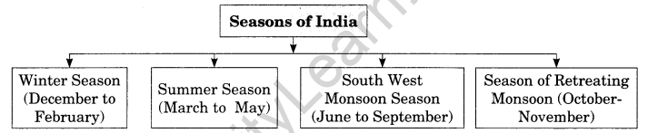
The monsoon may burst in the first week of June in the coastal areas of Kerala, Karnataka, Goa and Maharashtra while in the interior parts of the country, it may be delayed to the first week of July. The day temperature registers a decline of 5°C to 8°C between mid- June and mid-July.
The mean daily temperature remains below 21°C over most parts of northern India. The night temperature may be quite low, sometimes going below freezing point in Punjab and Rajasthan.
The mean maximum temperature for January at Thiruvananthapuram is as high as 31°C, and for June, it is 29.5°C. Temperatures at the hills of Western Ghats remain comparatively low.
April, May and June are the months of summer in north India. In most parts of India, temperatures recorded are between 30°-32°C. In March, the highest day temperature of about 38°C occurs in the Deccan Plateau while in April, temperature ranging between 38°C and 43°C are found in Gujarat and Madhya Pradesh.
The average annual rainfall in India is about 125 cm, but it has great spatial variations.
The highest rainfall occurs along the west coast, on the Western Ghats, as well as in the Sub-Himalayan areas in the north-east and the hills of Meghalaya. Here the rainfall exceeds 200 cm. In some parts of Khasi and Jaintia hills, the rainfall exceeds 1,000 cm. In the Brahmaputra valley and the adjoining hills, the rainfall is less then 200 cm.
Rainfall between 100-200 cm is received in the southern parts of Gujarat, east Tamil Nadu, north-eastern Peninsula covering Odisha, Jharkhand, Bihar, eastern Madhya Pradesh, northern Ganga plain along the sub-Himalayas and the Cachar Valley and Manipur.
Areas of Low Rainfall: Western Uttar Pradesh, Delhi, Haryana, Punjab, Jammu and Kashmir, eastern Rajasthan, Gujarat and Deccan Plateau receive rainfall between 50-100 cm.
Areas of Inadequate Rainfall: Parts of the Peninsula, especially in Andhra Pradesh, Karnataka and Maharashtra, Ladakh and most of western Rajasthan receive rainfall below 50 cm. Snowfall is restricted to the Himalayan region.
The mean annual surface temperature of the earth in the past 150 years has increased. It is projected that by the year 2,100, global temperature will increase by about 2°C. This rise in temperature will cause many other changes: one of these is a rise in sea level, as a result of melting of glaciers and sea-ice due to warming.
Class 11 Geography Notes Chapter 4 Important Terms:
- Monsoon: Monsoon connotes the climate associated with seasonal reversal in the direction of winds.
- Weather: Weather is conditions of temperature, humidity, pressure, etc at a given point of time.
- Climate: Climate is condition of temperature, humidity and pressure for a longer period of time.
- Break in the monsoon: During the south-west monsoon period after having rains for a few days, if rain fails to occur for one or more weeks, it is known as break in the monsoon.
- Dust storms: Dust storms in the evening are very common during May in Punjab, Haryana, Eastern Rajasthan and Uttar Pradesh.
- Mango shower: Towards the end of summer, there are pre-monsoon showers which are a common phenomena in Kerala and coastal areas of Karnataka. Locally, they are known as mango showers since they help in the early ripening of
- mangoes.
- Blossom shower: With this shower, coffee flowers blossom in Kerala and nearby areas.
- Nor westers: These are dreaded evening thunderstorms in Bengal and Assam. Their notorious nature can be understood from the local nomenclature of‘Kalbaisakhi’, a calamity of the month of Baisakh. These showers are useful for tea, jute and rice cultivation.
- Breaks: The wet spells are interspersed with rainless interval known as ‘breaks’.
- Climatic region: A climatic region has a homogeneous climatic condition which is the result of a combination of factors.
- Disturbances: Inflow of western cyclones is generally known as disturbances during the winter season.
- The Inter tropical convergence zone (ITCZ): It is a low pressure zone located at the equator where trade winds converge, and so, it is a zone where air tends to ascend.
- Monsoon trough: In July, the ITCZ is located around 20°N-25°N latitudes over the Gangetic plain. These are sometimescalled the monsoon trough.
- ITCZ: The inter tropical convergence Zone (ITCZ) is a low pressure zone located at the Equator where trade winds converge and so it is a zone where air trends to ascend. In July the ITCZ is located around 20°N-25° N latitudes (over the Gangetic Plain) sometimes called the monsoon trough.
- Northeast monsoon: In winter, the ITCZ moves southward, and so the reversal of winds from northeast to south and southwest, takes place. They are called northeast monsoons.
- Tropical depressions: Inflow of western cyclones is generally known as tropical depressions during the south-west monsoon period in India.
- Bardoli chheerha: In Assam, Nor Westers storms are known as “Bardoli Chheerha”.
- Loo: Hot, dry and oppressing winds blowing in the Northern plains from Punjab to Bihar with higher intensity between Delhi and Patna.
- Bursting of the monsoon: High velocity winds with extreme thundering and lightening . cause sudden rainfall. It is
- Jet stream: The winds blow across the Asian continent at latitudes north of the Himalayas roughly parallel to the Tibetan highlands are called jet stream.
- Monsoon winds: Winds that bring rainfall are called monsoon winds.
- Drought: It is a situation of scarce rainfall causing problem of usable water, failure of crops and sometimes famine like conditions.
- Western cyclone: The western cyclonic disturbances enter the Indian subcontinent from the west and the north-west during the winter months. It originate over the Mediterranean Sea and are brought into India by the westerly jet stream.
- Tropical cyclones: Tropical cyclones originate over the Bay of Bengal and the Indian Ocean. These tropical cyclones have very high wind velocity and heavy rainfall.
- October-heat: Owing to the condition of high temperature and humidity, the weather becomes rather oppressive and this is known as the October-heat.


