| Board | CBSE |
| Textbook | NCERT |
| Class | Class 10 |
| Subject | Social Science Geography |
| Chapter | Chapter 7 |
| Chapter Name | Lifelines of National Economy |
| Number of Questions Solved | 7 |
| Category | Map Work Skills |
Class 10 Geography Map Work Chapter 7 Lifelines of National Economy


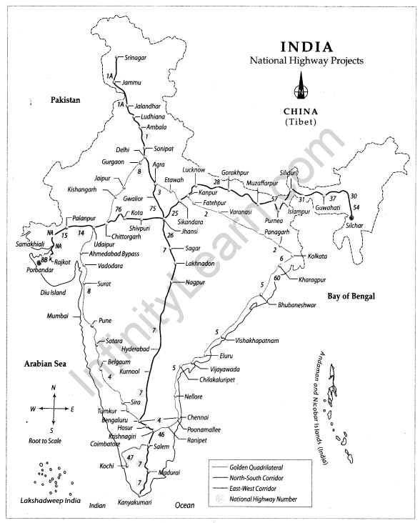
National Highway Development Project
The National Highway Development Project is a project to upgrade, rehabilitate and widen major highways in India to a higher standard.
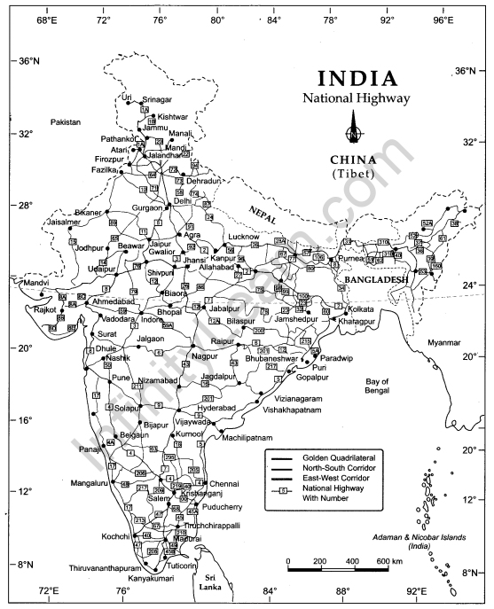
National Highways
This map shows the National Highways. NH-7 is the longest National Highway of India, while NH-47A is the smallest.
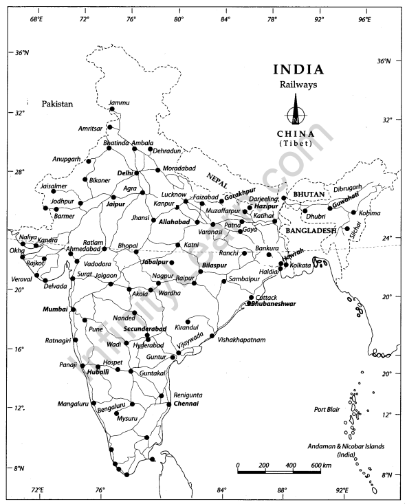
Indian Railways
This map shows the railway network of India and its zones. Presently there are 17 railway zones.
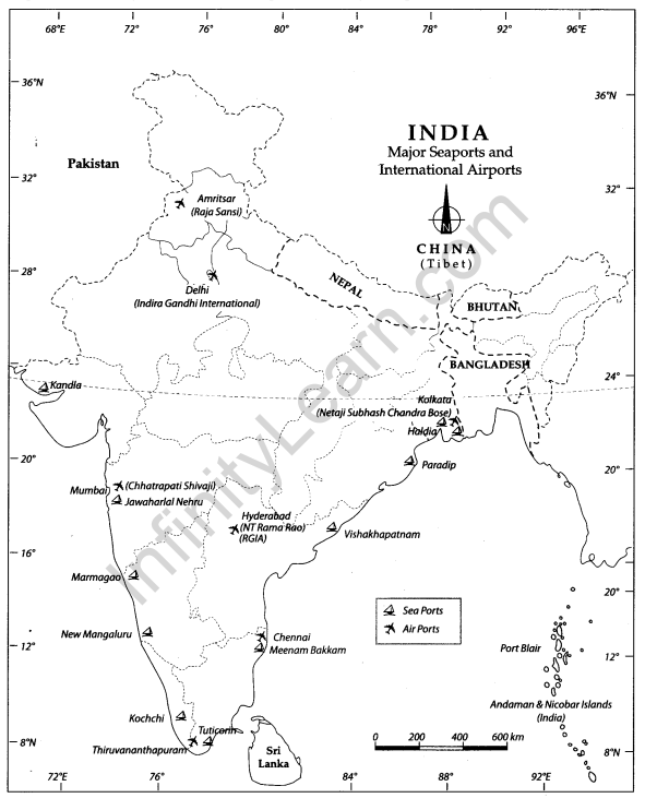
Major Seaports and International Airports of India
This map shows the major international airports and major seaports of India
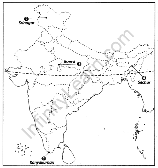
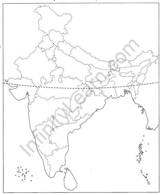
Question 1.
Features are marked by numbers in the given political map of India. Identify these features with the help of the following information and write their correct names on the lines marked in the map.
1. Southern terminal of North-South Corridor [CBSE 2012, 11]
2. The northern terminal of North-South Corridor [CBSE 2014, 12, 11]
3. The place where North-South and East-West Corridor meet
4. The easternmost point of East-West Corridor [CBSE 2012]
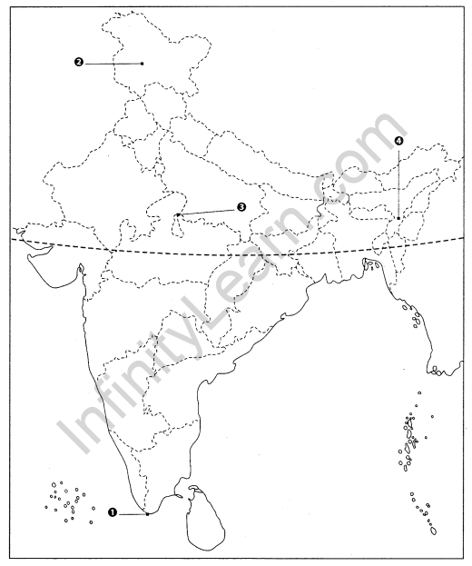
Answer
1. Kanyakumari
2. Srinagar
3. Jhansi
4. Silchar
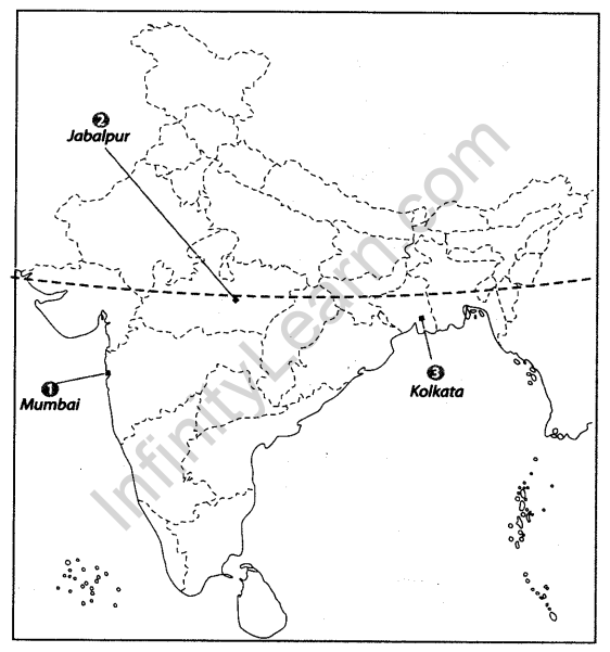
Question 2.
Locate and label the following items on the given map with appropriate symbols.
1. Porbandar
2. NH-2
3. NH-8

Answer

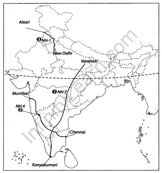
Question 3.
Locate and label the following items on the given map with appropriate symbols.
1. Longest National Highway of India
2. NH 4- Mumbai to Chennai
3. NH-1

Answer
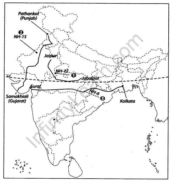
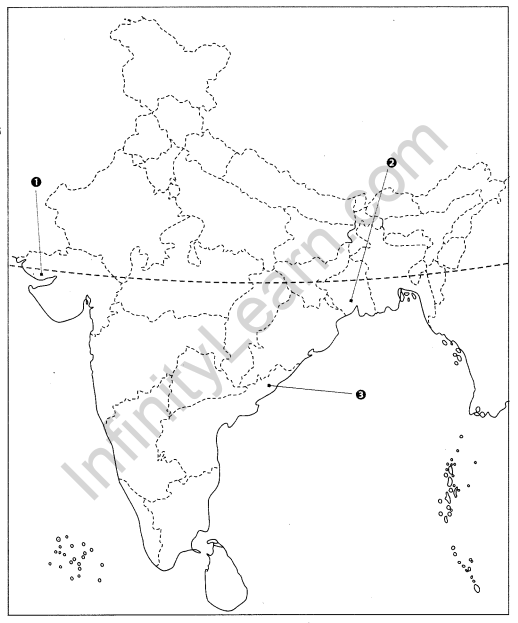
Question 4.
Features are marked by numbers in the given map of India. Identify these features with the help of the following information and write their correct names on the lines marked in the map.
1. National Highway Connecting Jaipur to Jabalpur.
2. National Highway Connecting Pathankot (Punjab) to Samakhiali (Gujarat).
3. National Highway Connecting Surat (Gujarat) to Kolkata (West Bengal).
Answer
Question 5.
Locate and label the following items on the given map with appropriate symbols.
1. Headquarters of Central Railways
2. Headquarters of West Central Railways
3. Headquarters of Eastern Railways

Answer
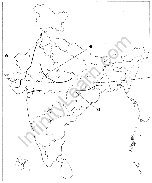
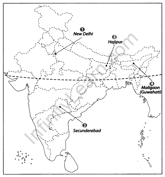
Question 6.
Features are marked by numbers in the given map of India. Identify these features with the help of the following information and write their correct names on the lines marked in the map.
1. Headquarter of Northern Railway
2. Headquarter of East Central Railway
3. Headquarter of South Central Railway
4. Headquarter of North-East Frontier Railway
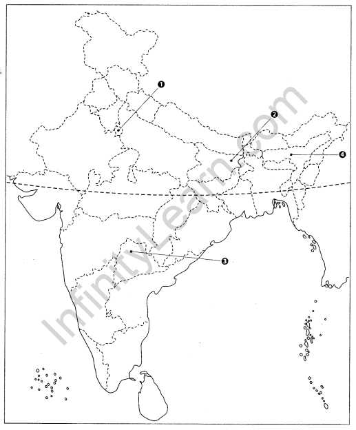
Answer
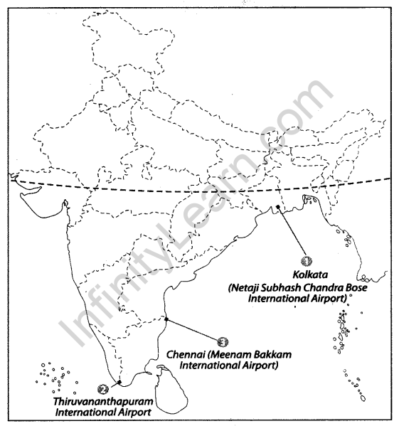
Question 7.
On the given political map of India, name and locate the following
1. Netaji Subhash Chandra Bose Airport
2. Thiruvananthapuram International Airport of India
3 Meenam Bakkam International Airport
Answer
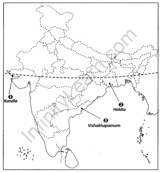
Question 8.
Features are marked by numbers in the given outline map of India. Identify these features with the help of the following information and write their correct names on the lines marked in the map.
1. A SeaPort located in Gulf of Kutch
2. A Sea Port
3. India’s second largest part by volume of cargo handled
Answer
We hope the given CBSE Class 10 Geography Map Work Chapter 7 Lifelines of National Economy will help you. If you have any query regarding NCERT Class 10 Geography Map Work Chapter 7 Lifelines of National Economy, drop a comment below and we will get back to you at the earliest.


